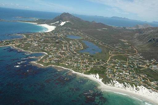
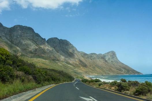
Betty's Bay is a beautiful small holiday town situated on the Overberg coast of South Africa's Western Cape province. Just an hour’s drive from Cape Town it sits beneath the rugged Kogelberg Mountains on the scenic R44 ocean drive between Pringle Bay and Kleinmond. Tourism plays a large role in the town's economy due to the its popularity with holiday makers from across the Western Cape and Cape Town in particular. This village is the longest in South Africa at over 13 km.
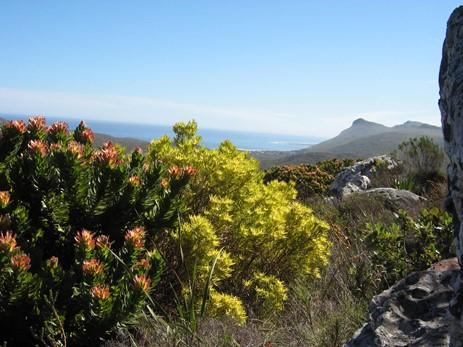
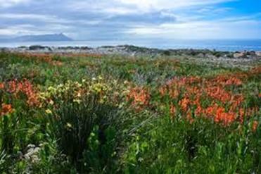
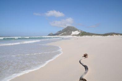
Betty's Bay is situated in an area known as the "Heart of the Cape Fynbos Floral Kingdom". The area is considered to be of such ecological importance that in November 1998 it became the first UNESCO-declared Biosphere Reserve in Southern Africa. It's historical background is rich with wild and romantic stories of shipwrecks, pirates, runaway slaves, cattle-thieves and strandlopers. In fact the area became the stronghold of outlaws and the remnants of Khoisan tribes for almost two centuries. Although hunting was possible they lived mainly from the sea, collecting shellfish and trapping fish.
However, man's roots in this area go back even further. William Paterson, who travelled the region between Somerset West and Bot River in 1771, gave accounts of wild life such as zebra, bontebok, buffalo, eland and even hyena. However, man's roots in this area go back even further. At De Kelders, the only fresh water caves on the coast of Africa, archaeological digs uncovered artefacts of a civilisation dating back 80 000 years ago. At Hangklip stone hand-axes from the Neanderthal era about 20 000 years ago have been unearthed.
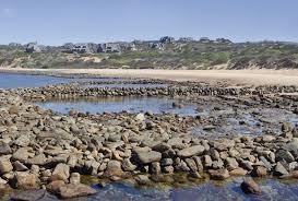
Khoisan strandlopers used to leave their fish traps and middens along the coastline. Close to Betty's Bay stone-packed fish-traps are still visible at low tide. Shell middens are found all along the coast. During Colonial times Betty's Bay was a favourite place for runaway slaves.
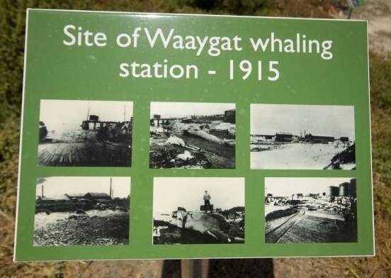
According to a brochure of the Tourism Board a whaling station was established in 1913, at Stony Point on land belonging to a Mr. Walsh who leased 60 acres to Mr. Frank Cook who employed a small group of Norwegians. They built the station and managed the factories. In 1917 Irvin & Johnson Ltd. took over the whaling station, which they operated till 1930 when the price of whale oil had fallen to such an extent that the whaling station finally closed.
Remains of the whaling station can still be seen at Stony Point. Of the large constructions like the boiler shed, the blubber house (the old building that served as a whale-oil warehouse.) the oil storage tanks, the employees' quarters, meat house, guano factory and pump house, not much is to be seen.
The land was later sold to a consortium consisting of Arthur Youldon, Jack Clarence and Harold Porter, who called this the Hangklip Beach Estate. Three towns were established namely, Rooiels, Pringle Bay and Betty's Bay.
Betty’s Bay is said to have been named after the daughter of Arthur Youldon.
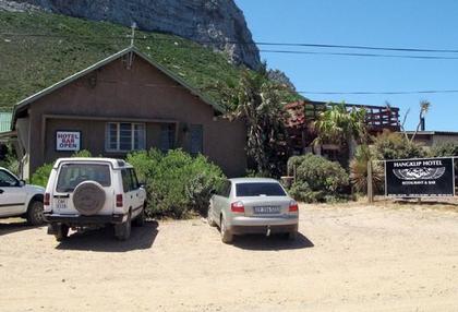
During the Second World War the Hangklip Hotel was the barracks for personnel manning the (still visible) radar station high on the slopes of Hangklip Mountain, watching out for German U-boats. Another radar station was situated at what is now Mooihawens.
Italian prisoners of war did construction and built the road from Gordon's Bay, which is now known as Clarence Drive. Prior to this the area was accessed via Sir Lowry’s Pass and Kleinmond with a pontoon crossing the Palmiet River. The difficulty experienced in travelling to Betty’s Bay prior to World War II kept it off the map for most people in the early days.
The fact that electricity was introduced to Betty’s Bay only in the 1990s meant that the village had limited appeal. This has stemmed the development and allowed Betty’s Bay to remain pleasantly underdeveloped.
Four diverse municipalities .. each with their own character, are now united and share a common destiny. To a large extent the Overstrand is the result of a forced marriage brought about by the municipal demarcation process some thirteen years ago. The four diverse municipalities of Gansbaai, Stanford, Hermanus and Hangklip-Kleinmond, each with their own character, are now united and share a common destiny.
This is an updated version of the classic text by Colin Chapman